|
Potosí is one of the highest cities in the world, lying in the south of Bolivia's highlands at 4090 m. It gained historical importance due to the silver mining from the mountain Cerro Rico by the Spanish during colonial times (60% of the world's silver stemmed from here). Potosí became the richest city of all South America and was the location of the Spanish colonial mint for centuries. Due to its wealth, beautiful palacios and numerous churches and convents were built, which are nowadays protected by UNESCO world heritage. Today, tin, copper and silver are still mined at Cerro Rico, but the city's population is poor and working in the mines is dangerous (still today there are children working underground and life expectancy in the mines is only 15 years). We arrived in Potosí from La Paz by night bus in the early morning. Unfortunately, Fabienne had caught food poisoning and was grounded for three days. Philipp could in the meanwhile climb the Cerro Rico mountain (4’800 m) and witnessed the dusty, strenuous workplace of the miners. Local travel agencies offer daily tours into the mines - including a dynamite explosion -, but we didn't go. We were rather shocked how money is made out of this poor people's struggle for a living and it offered us a lot of food for thought. Next time we consider buying silver ware (same goes for other precious metals), we might think twice!
0 Comments
Once we had found out, that in Bolivia, close to La Paz, there is a mountain of above 6000 m altitudes that can be climbed also by beginners, the seed was planted. We felt confident fulfilling all necessary conditions – being physically fit and well acclimatized – and were ready for our next adventure. In La Paz there are numerous agencies offering a three-day expedition to Mount Huayna Potosí. We had chosen the company “Refugio Huayna Potosí” because it has its own camps and it was the only agency that enquired about our health and level of fitness before selling the tour to us. The guides and the cook did an amazing job during our expedition and contributed significantly to this fantastic experience. The owner, however, is best to be avoided: we had an outrageously bad encounter with him and were treated disrespectfully. On the first day we collected our material (harnesses, ice axes, crampons, plastic climbing boots, gaiters, clothes, helmet, etc.) and were driven to the Base Camp at the foot of Huayna Potosí on 4700 m. After lunch, we walked up to the Potosí glacier, where our first guide Celestino, trained us on how to walk on the glacier with crampons and how to climb steep passages. As a final treat, he took us on the rope and we could climb a wall of ice. This was a lot of fun, despite the foggy conditions! The evening was at our free disposal. After dinner, we tried to light a fire in the chimney, as it was humid and freezing cold. We succeeded only partially and thus opted soon for our bunk beds to catch at least some decent sleep during the first night. On the second day, we were spoilt with an abundant and yummy breakfast (the best we have had since travelling in Bolivia, who would have expected this in this remote location!). Unfortunately, Philipp could not fully enjoy it, as his stomach was rebelling – we still don’t know whether it was the dinner or the altitude. However, after an easy and relaxing walk along the dammed lake of the hidroelectrico in the warming sun, he started to feel much better and we were confident again to tackle the ascent to the High Camp on 5300 m. After lunch, we met our guide for the summit, Esteban, and mounted together to the High Camp. It consists of three huts, which were only built a year ago. Surprisingly, it was warmer here than at the Base Camp! Esteban cooked soup for all of us and after 6 p.m. we had to try to catch some sleep until midnight. We were so happy, when we could finally get up at midnight! Due to the height and surely also due to a certain nervousness, we couldn’t sleep at all and were impatient to start the climb Huayna Potosí. After “breakfast”, we walked to the glacier and mounted our crampons. We started our climb at 1 a.m. and the ambiance was magical: the sky was clear and we were gazing at the stars while we could see the lights of La Paz in the distance. Like a lantern procession we saw the other rope teams from the lower camps of the other agencies. The ascent was steep but continuous and although we were breathing hard, we didn’t feel any complicacies due to the height. Just around 5800 m there was a steep passage to climb and the last part to the peak was technically more demanding as it sometimes lead over rocks covered with ice. After a narrow crest we were there: “el cumbre”! Esteban congratulated us (as a nice detail we were also the first rope team to reach the peak that day), it was shortly before 5 a.m. and the sun was about to rise. As the actual peak is very narrow it only allows space for a handful of people; we therefore had to start descending soon to make room for others. Scenery wise, the descent was even more rewarding: by daylight, we could now see the fairytale beauty of the glacier landscape, we had passed before in pitch darkness. We felt incredibly happy to having achieved this! It was a beautiful morning and the descent came nearly for free. At 10 a.m. we were back at the Base Camp and after lunch we were driven back to La Paz. Exhausted, but still enchanted by this experience we opted for a hot shower and long sleep! That’s how bus operators praise their destinations at the bus terminals. After listening to this melody for 30 minutes in Copacabana, we were glad when the bus finally left. Laid out in a canyon on 3200 to 4100 m, La Paz is the administrative capital and seat of government of Bolivia and counts over 2 million inhabitants. Two majestic mountains overlook the city, Mount Huayna Potosí and Mount Illimani. We entered La Paz by bus through the neighbourhood of El Alto and were very pleasantly surprised by the ambiance of the city. We perceived it as extremely lively, vibrant and authentic. The Aymará people dominate the streets and countless markets take place daily. While we were there, the festivities of “el dia de todos los santos” on November 1 and 2 were to be prepared and celebrated. We noticed that something special was about to happen, because on the markets large varieties of flowers, pastries and bread in the form of men, women, horses and Ilama with porcelain or plastic masks as faces were sold. We then read up on the festivities and found out that in La Paz they are a combination of Aymará culture – where the deaths are believed to descend amongst the living family members during 24 hours and are welcomed to a richly decorated table – and the Catholic practice of “All Saints”, where the deaths are remembered. If you are interested further, we have found this movie, which explains it quite well. As traditional and colonial La Paz is at first sight, as progressive it can be as well. Along the main axis – El Prado – one can find all global players of big companies as in any other big South American city. Since 2015 La Paz is proud owner of an urban cable car network (built by the Austrian/Swiss Doppelmayr/Garaventa group). The lines are red, yellow and green (representing the colors of Bolivia’s flag) and intended to free the city’s streets of the heavy traffic. Considering the difference in altitude of the city, a cable car really seems to be the best choice. We walked up the manifold stairs to the neighbourhood El Alto one morning and took the red cable car line back to the center – for the Swiss, it felt like being in a mountain resort at home. 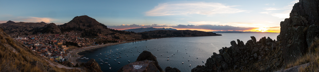 Lake Titicaca is the world's largest high-altitude lake on 3808 m, measuring 15 times the size of Lake Geneva. The Inka considered it their birthplace of civilization. Today it lays within the territory of the Aymará; 60% within Peru's and 40% within Bolivia's borders. The lake is famous for its islands: Isla del Sol and Los Uros. When we arrived in Puno, we were amazed by the sunny and warm weather. Pair this with the stunning views over the scintillating Lake Titicaca and you might understand why it felt marvellous after a cold and rainy day in Cusco!
Instead we walked along the lakeside promenade, strolled through the lively Saturday market (on weekends the daily markets in Peru are enlarged and instead of offering food only, you can find clothes, shoes, household equipment and other fancy stuff such as chicken, cuy, dryed body parts of various animals etc.), witnessed two weddings with Marachi bands in front of churches and visited the Catedral. For our last evening in Peru - since we would be crossing the border to Bolivia the next day - we indulged into a delicious French-Peruvian-Cuisine Menu with a glass of perfectly matching Malbec. Life was very good:-)! For the first time, we tasted "cuy", but it wasn't love at first bite... "Alpaca a la plancha" and "Lomo saltado" are still our favourites. Crossing the border into Bolivia was tedious and involved a lot of filling in forms and queuing, but else, it was rather unspectacular. Happy to have received 30 days stay permit without any hassle, we arrived in the quaint town of Copacabana. Copacabana (yes, the beach in Brazil is named after this small town at the shores of Lake Titicaca) is famous for its shrine of the "Virgen de Copacabana" from the 16th century, which stands in the Basilica and is the reason for pilgrimage still today. The small town is a tourist attraction in Bolivia, mostly because of its public beach and the numerous restaurants offering rainbow trout from the lake. For us, staying in Copacabana, allowed for an extra bit of luxury and relaxation. We had rented a fancy bungalow for three days at the properties of "Las Olas" and enjoyed unwinding there. The views on the lake from the hammocks were priceless and we also profited of having our own small kitchen (all the fruit and veggies on the market we could finally buy and eat and not only look at!!) and especially the cosy fireplace in the evening. The Ausangate Trek is definitely the most beautiful trek we have ever made and surely the highlight of our time in Peru! We marched within breathtaking landscape, climbed four high passes, camped at remote sites with vistas on a laguna or over a plain of herding alpacas, we awed at colorful rocks or felt very humble beneath wide ice fields and glaciers. The trek around Nevado Ausangate covers roughly 65 km and is usually hiked in five days. It is said to be the highest trek in Peru as most of the trail is above 4000 m (the highest pass is at 5150 m), which naturally results in low temperatures, especially during the nights. 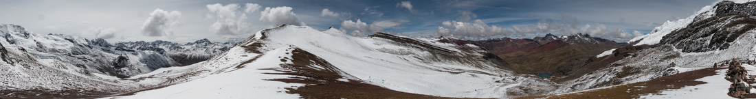 We read on a few blogs, that the trek is supposed to be difficult and tough. For us, we did not encounter any difficulties, however we planned our routing carefully and always tried to start hiking in the early morning, as at this time of the year heavy showers are common in the afternoon. We perceived the trail as moderate (we could hike it easily in our trekking shoes), the climbs were gradual and only occasionally there was a steep slope. One needs to be in good shape and of course well acclimatized, because of the constant high altitude (also for sleeping). We didn't have any problems with the altitude, maybe also because we were eating Coca toffees while climbing :-). Our GPS, though, was extremely helpful, as sometimes the track was lost or altered due to the landscape (there are many marsh districts). We decided to trek solo and therefore made the sacrifice to carry our equipment and food for five days with us. It was totally worth the effort, as one of the most beautiful facts about this trek is that you are basically alone for the entire time. We only passed some shepherds, camped next to one guided tour during the first night and met one other couple at the Palomani peak that also trekked independently. We will never forget the vastness, wilderness and rough beauty of this region. Mount Ausangate is the "apu" (= mountain God) of Cusco and the Inka considered the entire Ausangate region holy. Still today there is a yearly procession by the Quechua people in this region. We can totally understand why! While preparing for the Ausangate Trek, we found it difficult to gather useful information; maybe because most people hike it on a guided tour. For the ones that are interested in independently hiking this trek, we are writing down our itinerary below. For the other ones: Feel free to stop reading and enjoy the pictures of which there are plenty - selecting pictures was rarely more difficult than this time :-). There seems to be (rather lousy) maps available from the South America Explorers Club. We were glad to rely on a good GPS device with tracks, freely available from wikiloc. Water is available from relatively pure streams along the whole route; either bring a water filter or disinfection tablets. Day 1: Travel from Cusco to Tinki by bus and hike to Upis (ca. 3.5 h) The Salaywa bus company runs busses to Urcos-Ocongate-Tinki daily and roughly by the hour from Livitaca terminal in Cusco. The journey costs 10 Soles/person and takes approximately 3.5 hours. We took the bus after eight in the morning and were in Tinki shortly after midday. It's a local bus, so it stops at every corner and gives a lift to many indigenous people. We also were about the only "gringos" on the bus and for the first time felt looked at, albeit still very friendly. In Tinki we enjoyed a hearty "menu almuerzo" with soup, rice, potatoes and a few bits of meat (perfect as you need lots of carbohydrates and liquids when performing in high altitudes) for 5 Soles/person. We made the owners very proud because we ate in their restaurant as "gringos" :-)! Afterwards we finally started the trek: at the trailhead in the heart of Tinki we signed into the trail book, indicated the number of days we intended to spend, paid 10 Soles/person entry fee and even received plastic bags to carry out our garbage again. Then we followed the road uphill through Tinki, along fields and dispersed houses towards Upis. Every now and then a motorbike, man on a horse, children and women coming from the fields passed us. After about two hours of walking, the landscape became rough and less inhabited. We walked across pastures - always facing Mount Ausangate - until we reached a plain with marsh and a few houses and hot springs. This is the Upis basecamp on 4400 m and the campground is very well signed and laid out. There are also pit toilets and garbage cans. We arrived there just around 4 p.m., keeping in mind that night falls already at 6 p.m., we had made it in the right time and could set up our tent and cook dinner comfortably. Day 2: Upis to Laguna Ausangate via Arapa pass (4850 m) and Ausangate pass (4900 m) (ca. 6 h) We left Upis shortly after 7 a.m. and climbed the Arapa pass. The climb was gradual and we reached the pass after 1.5 hours. The path further led downhill into a plain and towards three lakes. Generally, the path was well visible, we only had to be careful and take the track on the right side at the first lake (do not follow it on the left side towards the Mirador, this can be misleading). After the third lake, the path started climbing gradually again and we reached the Ausangate pass just after midday. From this pass we could already see the Laguna Ausangate and our second camp, to which we descended to 4650 m and arrived there shortly after 1 p.m. Just as we had pitched our tent, rain and snowfall set in and we had to slip into our sleeping bags in order to stay warm. Luckily, just before dusk, the precipitation ceased and we could cook dinner and make hot tea. A woman passed by to collect the camping fee of 20 Soles. In principal, there are even flush toilets available; not surprisingly they did not work. Day 3: Laguna Ausangate to Jampa via Palomani pass (5150 m) and peak (5230 m) (ca. 8 h) When we opened our tent in the morning, we were in winterwonderland: a thin layer of snow covered everything. Taking breakfast was freezing, but when we started hiking at 7:30 a.m. the sun was already out and the snow melted quickly. The entire climb to the Palomani pass, however, we walked on crispy snow, which made it even more magical: we saw a small herd of vicuñas and were all excited, as for the first time in our lives, we passed the altitude of 5000 m. After two hours we had reached the pass and since we felt fit enough we continued climbing along the crest to the peak. The 360-degree-view from the top was breathtaking; we could even see the famous rainbow mountains. For the following three hours the path led downhill into a valley and plain. In the plain there was a wide marsh and we shortly lost the track. If you follow the path that looks most walked on (watch out for mule tracks and do not follow the small and steep alpaca trails) you should be fine. After the plain the path gradually but moderately climbed again and after 1.5 to 2 hours we reached Jampa and the next camp. Unfortunately, it was in bad conditions (the sanitary facilities were locked up) and there was no good water source (the nearby stream is full of sediments and bright red in color, probably due to iron oxides) so we continued walking towards Jampa pass, until we reached a high plateau (4750 m). There, the stream of water was clear and we asked permission from a shepherd whether we could camp here overnight (he charged us 20 Soles). Day 4: Jampa to Pacchanta via Jampa pass (5050 m) (ca. 6 h) Overnight, snow had fallen once more and our tent was covered with an icy layer. As the day before, though, the snow quickly melted once the sun was out. We started climbing the Jampa pass at 7:30 a.m. and fairly quickly reached the altitude of 5000 m. From there, however, the path kept the height and stretched for another 2 km until we reached the pass itself. Afterwards the trek continued mainly downhill, passing several shepherd’s pastures where women sold their handicraft, leading through a seascape with beautifully laid viewpoints and two camps, until it ended at the village of Pacchanta. We arrived there after 1 p.m. Pacchanta has hot springs and an official camp. However, we camped at the campsite of a small and very basic hostel just at the entry of the village, as the official camp was very dirty and the toilets not working. The owner was very friendly and charged us 10 Soles for the campsite. She even opened the hostel’s community room, so that we could cook in shelter (as it started raining in the afternoon again). Snacks and drinks are available from Mini Markets in Pacchanta. We didn’t use the hot springs as some of the pools looked rather turbid… Day 5: Pacchanta to Tinki (ca. 2.5 h), bus ride from Tinki to Cusco Luckily, in the morning the rain had ceased again and we could start our walk back to Tinki in sunshine. We started early again at 7 a.m. and simply followed the road. For some part we were accompanied by a local guide and crossed several children on their way to school. As Tinki is very dispersed, we go the feeling to have reached it fairly quickly, however, don’t underestimate the time it takes until you reach the market place in the center from which the buses depart to Ocongate-Urcos-Cusco. They run every half an hour and we caught the one leaving at 10 a.m. The tickets can be purchased directly in the bus; as with the outward journey, Salaywa charges 10 Soles/person. Before leaving, we quickly bought some fresh bread and fruit (what a treat!) in one of the market stalls to eat in the bus. After 3.5 hours of bus ride we were back in Cusco around 2 p.m.
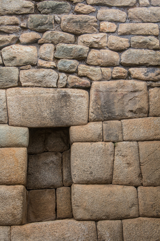
A mini-bus drove us from Cusco to Hidroelectrico, from which we walked the 11 km through cloud forest along the railway lines to Aguas Calientes (also known as Machu Picchu Pueblo), where we spent the night, before climbing to the ruins in the early morning. The prospect of seeing Machu Picchu during sunrise was tempting, unfortunately it was raining heavily that day and we visited the citadel while it was in the clouds (and we were thoroughly wet and cold). Nevertheless the place worked its magic and we were especially fascinated by the Inkan astronomical knowledge and building technique, which was so accurate that no mortar was needed to fit the huge blocks of stones. Our Peruvian "guía" held an entertaining and insightful tour in Spanish and it was good for us to train our listening skills and to mingle with other, South American tourists (we were “grupo Condor” ;-)). All in all, we had to realize that we aren’t made for group tourism, though. Having travelled independently for several months we are simply too impatient and spoiled. Waiting for fellow group members or guides to organize stuff we could have done ourselves (quicker) was too strenuous for us. Do we grow antisocial!? For the ones planning to visit Machu Picchu: In retrospect, we would call for braving the gap and consider not visiting Machu Picchu (it is rumored to be closed within the next two years entirely anyways as it is endangered to fall apart). Or, we strongly advice organizing the trip yourself. During shoulder season (October to March) it is no problem to receive entry tickets in Aguas Calientes directly for the next day. The same is true with finding an accommodation there. We think, however, that it is a good idea to book the transport from Cusco to Hidroelectrico and back with a tour agency, as otherwise you would need to change colectivo-taxis three times and it just takes longer. Beware that you only book the transportation, without included lunch during the stop in Santa Maria/Santa Teresa. This should cost you around 30 USD. Numerous tour agencies can be found around Plaza de Armas; check multiple offers and don't buy the tour from a vendor directly in the street. If you are up for a bit of nerve tackling, you can also just go in front of the Catedral around 7:30 a.m. and try to catch a tour mini-bus with spare seats.
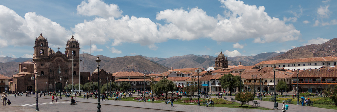 Cusco is the ancient capital of the Inka empire - many ruins remained and colonial buildings were often just built upon Inkan fundaments - and it is still a vibrant city, high in the Andes at 3400 m. We were astonished and amazed by the city's ambiance and liked it very much, especially the historic center. Initially, we feared it would be extremely touristy, but at least at this time of the year the tourist masses dispersed well. In fact, Cusco was the ideal base for us to plan and head out for an excursion to Machu Picchu and a multi-day trek in the Ausangate region (see next posts). When in town, we took the time to stroll around the manifold alleys of the San Blas neighbourhood and the streets around Plaza de Armas. We tried delicious Alpaca meat and feasted on the variety of fresh (to us exotic) fruit on the markets. It also offered the so far rare opportunity to take pictures of typical scenes of Peruvian ordinary life. We were very fond of the children's behaviour and the colors of the traditional dresses.
Arequipa is the second largest city in Peru and its historical centre with buildings of white sillar stone belongs to the UNESCO world heritage. The city's wealth stems from its trade with Alpaca wool with the UK. Its townscape is extraordinarily beautiful thanks to the monuments built by the Conquistadores: wealthy business men's palacios, the cathedral, numerous churches and the monastery of Santa Catalina, all beautifully illuminated by night, make for the impression to be set back into colonial times. Arequipa is encircled by three volcanos and situated in the middle of a stony desert. This leads to an arid climate nearly year round and we enjoyed sunshine and hot temperatures for our entire stay.
Culturally and gastronomically, Arequipa also had to offer a wide range. We didn't visit the monastery of Santa Catalina (we felt already spoilt by having visited similar clerical institutions in Sicily, Andalucia and Morocco previously), but went to the museum of the Catholic University, where the Inka mummy of "Juanita de los hielos" and its excavation was exhibited. The mummy was only found in 1995 at the peak of the volcano Ampato and greatly contributed to the further understanding of the Inka culture as it was astonishingly well preserved. For the first time, we found vegetarian restaurants offering creative and very tasty daily menus and we sipped a Pisco sour on a terrace overlooking the Plaza de Armas.
Halfway in between Arequipa and Cusco lays the region of the Colca Cañon. The canyon is more than 1000 m deep and thus twice as deep as the Grand Canyon in the US. To us, however, it appears less like a typical canyon because of the ancient Inka terrace fields along its flanks. Two indigenous people, the Collahuas and Cabanas (they can be distinguished by the women's traditional hats) have inhabited this region for centuries. Hot temperatures during the day, merciless exposure to sun and windy and cold nights seem to make agriculture extremely difficult. The land however appears abundantly fertile, though, where water is available from drainage systems. Tourism allows for an extra income in this area, attracting tourists because of its unique landscape ideal for trekking and the natural habitat of the Andean condor, Peru's proud emblem aside the llama and alpaca.
And those were also the reasons why we had decided to visit Colca Cañon. Since no major bus company (yet) serves this region, we took a local bus from Arequipa, via Chivay to the ramshackle village of Cabanaconde.
In Cabanaconde we stayed at a backpackers hostel, together with the handful of other tourists that arrived on the same bus with us. This is only logical as Cabanaconde has literally three hostels and only this one has a website :-). We met another Swiss couple, Sophie and Jonny, who also travel South America on a similar itinerary and at exactly the same time as we do. It was great to share our travel experience and to receive valuable accommodation tips for our next destinations.
Early next morning, we descended towards Sangalle, the oasis of the canyon with palm trees and swimming pools. It represents a striking contrast to the otherwise dry, dusty and rocky landscape and as such looks beautiful. From Sangalle we climbed the other side of the canyon to the village of Malata and continued deep into a branch of the canyon to a hamlet called Fure. The ascent in the heat of the afternoon was extremely strenuous. We were though rewarded by seeing a couple of Andean condors circling in a thermal high above our heads. For the first night we then descended near the village of Llatica, where we set up our tent on a terrace next to the drainage system (how convenient to have your own water supply just aside!). The night was clear and the sky full of stars. Since darkness fell so early, we slept for full 12 hours until sunrise. We thus felt energetic the next morning and arrived in Llahuar – a resort directly at the Colca river where we had planned to eat lunch and bathe in the natural hot springs – already at 10 am. The resort keeper looked at us slightly strange when we asked whether she could serve or sell us some food: the "menu almuerzo" would obviously not be ready before 1 pm. It is for such moments, that we always carry extra food with us, even if this consisted of biscuits and dried fruit and was less of a gastronomical highlight :-). We rested in the shade by the river and then set out for the big ascent to the top of the canyon. Luckily, there were clouds drifting in just around midday, and we could climb without the torturing hot sun. We felt extremely thankful for this! Just around sunset we had reached the crest and the viewpoint "Mirador Achachina". From here it was only half an hour walk back to Cabanaconde, perfect for us to undertake the next morning and to reach the first bus back to Arequipa. So guess what we did? Right, we set up our tent on the viewpoint’s wooden platform and enjoyed breathtaking vistas. A guided group of British tourists were quite bemused by this the next morning, but having watched the sunrise over the canyon out of our sleeping bags let us take in any comment very coolly.
After a hot shower back at the hostel, we felt ready to tackle the bus journey back to Arequipa. We got a bit shaky, though, when we saw the driver kneeling and repairing the rear tire and break when we approached the bus for departure... But except of some delay we once more arrived safe and sound at our destination. In Arequipa we even caught some of the last tickets for the night bus to Cusco the very same day. All worked out perfectly well!
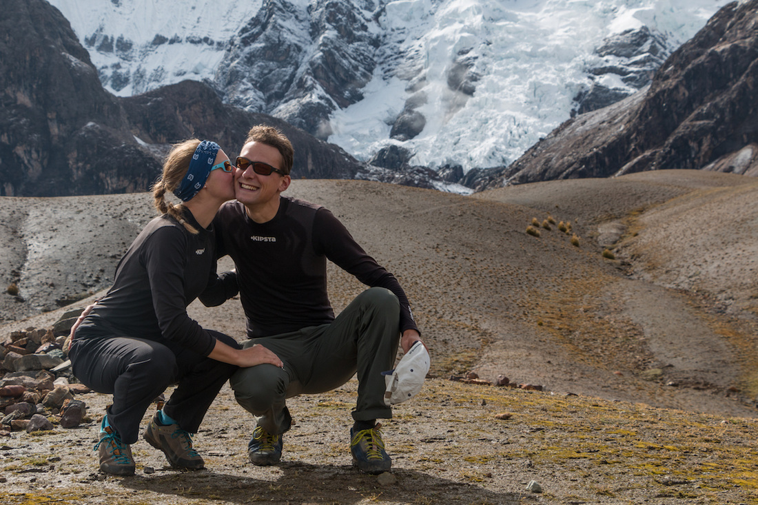
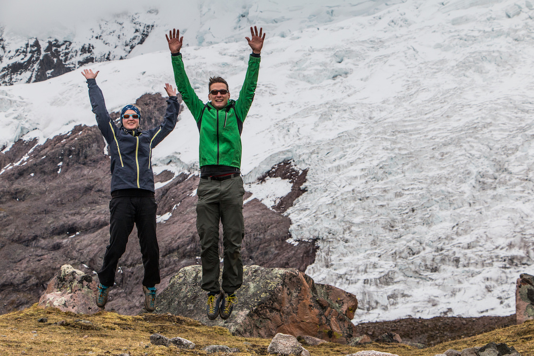
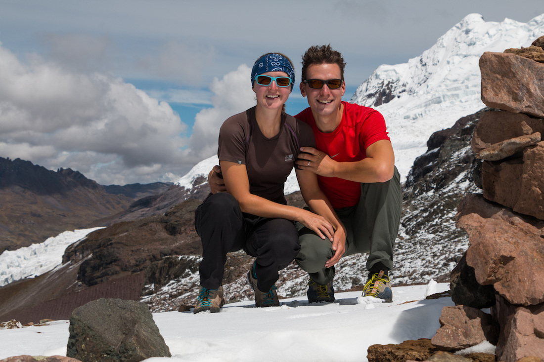
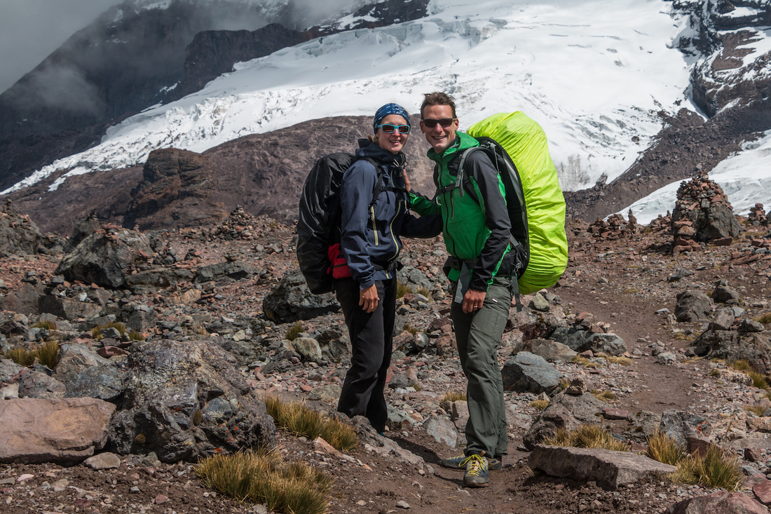
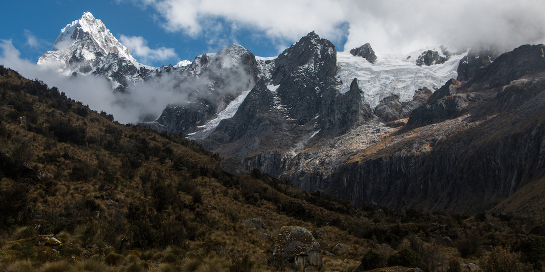
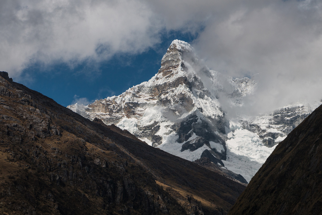
Contrary to the majority of hikers and all guided tours, we had planned to hike the Santa Cruz Trek from Cashapampa to Vaquería. This meant that we had to climb slightly more - which suited us just well because we prefer hiking uphill - but also allowed us to add the trek to Laguna 69 on our way back to Caraz. Early on the first day a colectivo taxi drove us from Caraz to Cashapampa in record time of less than an hour. We tried filming the bumpy ride, but it doesn't look half as spectacular as it was. By any means, we would recommend all automobile companies to testdrive their newest model five times on this lap with this driver and we would guarantee that it passes all durability tests... Good for us, we arrived safe and sound at the trailhead and set off from the village around 7 am. For the morning, the trail led fairly steep up a gorge, along a river of crystal clear water and past various cow pastures spotted by red-blossoming cacti until we reached the first camp on the highland around midday. However, we followed the Santa Cruz valley while several donkeys kept us company. In the late afternoon we reached Jatuncocha lagoon and decided to call it a day; after all, night would fall shortly after 6 pm. We set our tent up next to a bubbling mountain river and with a vista to one of the phenomenal glaciers around us. What a great setting to enjoy our spaghetti after a day of hiking! And believe it or not, we were sleeping by 7:30 pm. Day two promised to be an intense day, there was the pass of Punta Union to climb. We set off early in full sunshine to the end of the Santa Cruz valley. There we climbed up towards the Alpamayo base camp; a detour well worth it as we could see over the entire valley and had great views on peak Alpamayo and the well-known peak of the "Paramount Pictures" logo, actually called Artesonraju. Several guided tours and their donkey caravans crossed us around the last camp before the climb to Punta Union. The loaded donkeys looked very pretty and colorful in the midst of the landscape! We were amazed, though, by the equipment they were carrying: cooking tent, dining tent, restroom tent... If one can live without these amenities, we think it is very well possible to hike this trek independently. We had no issues at all finding the tracks; however, the weight on our shoulders was admittedly a challenge, especially in the heights. Despite being used to hiking, climbing the last few meters up to Punta Union on 4750 m was strenuous. Walking down to an appropriate height for a campsite felt like a walk in the park! Just before dusk we found another beautiful spot next to a river and set up camp. Dinner however was served inside the tent (still an unusual thing for us, as this would never have been wise to do in North America because of the bears), since this valley had a nasty plague of little biting flies. The third day was mostly about descending to Vaquería. After leaving the Huascarán National Park we walked through the picturesque peasant village of Huaripampa. Eco-tourism starts to flourish there, we saw cuy production farms that could be visited and indigenous women were selling their alpaca knit-work along the path. Happy, but exhausted from the final climb through terraces of potato fields and eucalyptus groves, we arrived in Vaquería in the early afternoon. We had made it: roughly 50km in three days :-)! The adventure though was not yet over: after refreshing ourselves with some sugary softdrinks and a banana from the food stalls around, a camion driver offered us a reasonably priced ride to Cebollapampa, the trailhead of the trek for Laguna 69, where we planned to spend the night. Instead of waiting for the next colectivo bus, of which no one knew when it will arrive, we gladly accepted the offer. What followed even excelled the initial taxi ride... For more than two hours (for only 24 km) we jolted on a winding "road" surrounded by some of the most impressive mountains of the Cordillera Blanca: Mount Huascarán and Pisco. Evidently it followed what could not be avoided: a flat tire. The driver and his teeny son changed it fairly quickly and with a sporty run down to the trailhead from the mountain road, we just managed to set up our tent before it was pitch-dark night. Cooking with our headlights on, though, was fun and the campground was unusually beautiful - we were glad to be here! The trek to Laguna 69 is said to be the jewel of the Huascarán National Park. We set off only with a daypack right after dawn and could enjoy the hike and the pretty laguna before the masses arrived. On a plain with grassland we also saw our first viscachas, an animal looking like a rabbit but with a long tail like a squirrel. They seem to be present in Peru's highlands as are the marmots in Switzerland. At midday we were back from the hike, put together our tent and waited along the mountain road for a ride back to Caraz. While waiting, we met a small group of French backpackers and together we were lucky to pin-down a tour bus that took us to Yungay. What a comfortable ride this was compared to the camion the day before! However, we have to admit, that it is always the unexpected and (at-first-sight) awkward situations that make for the best and unforgettable stories. After more than 26 hours of travelling we arrived at Lima airport around midnight. Immigration went smooth and even our luggage had made it through New York and Fort Lauderdale to here: what a promising start! A taxi took us from the airport into the neighborhood of Miraflores, where our hotel was situated. During the ride of approximately one hour through the megacity (Lima has around 10 million inhabitants) the taxi driver gave us a comprehensive summary about Peru's history and all sights worth seeing. He was kind enough to do so by slowly speaking Spanish, so that we could understand. The following four days we acted as the tourists we are and discovered the sights of Lima. Unfortunately, now in the transition season from winter to summer, the city is usually wrapped into dense fog (called "la garúa"), which made everything appear grey. Otherwise we for once enjoyed being in a city that is completely different to what we had experienced during the last months in North America. We walked within the masses of people in central, colonial Lima, rode on the public traffic and enjoyed the delicious, fresh food. All small restaurants offer a daily menu during lunchtime, which is limited in choice but includes two to three courses for not more than 10 Soles (approximately 3 CHF). We love this fantastic offer and used it daily. It is usually safe to eat in these restaurants... In some establishments it can be a bit of a gamble; we suspect this is also the reason why we had to take a down-day and can now write this blog post ;-). After Lima, we decided to head north into the Andes and travelled by overland bus to Huaraz. Huaraz is situated on 3050 m and the base for many hikes in Cordillera Blanca. The town itself - being the capital of the Ancash region - is quite big, counting 120'000 inhabitants, and has a pleasant but busy feeling. Our hotel was located directly in the market neighbourhood and it was fantastic to see all indigenous women in their traditional clothes selling their goods in the streets. We perceived the daily life in Huaraz more authentic than what we had seen in Lima and we enjoyed it a lot. The Peruvians were extremely friendly and hospitable towards us and showed great patience, when we tried to explain ourselves in Spanish. We were also very impressed by the natural pride the indigenous people show, even when the means are very basic. Some scenes - especially concerning traffic - did remind us vividly of India, however poverty is shown much less and a certain level of privacy is maintained under all circumstances. From Huaraz we undertook two day hikes in order to acclimatise to the high altitude. The first hike led us to a viewpoint, called Rataquenua, overlooking the town and the most prominent mountain Huascarán and led us back through a Canyon, called Puca Ventana. It was perfect for a first hike, as even when we were only climbing 600 m our hearts were heavily pounding and our bodies still needed to adapt. The next day we trekked to Laguna Churup on 4450 m. In order to get to the trailhead, we had to take a colectivo (a van that serves as shared taxi) from central Huaraz, taking us through small peasant villages to the portals of the Huascarán National Park in Pitek. The trek to Laguna Churup was very impressive. At first it ascended fairly on a very well laid path, then we had to climb with the help of ropes before reaching the lake. The lagoon itself was marvelous and the water crystal clear! After eating our lunch we soon descended as the weather turned and we even got some hail and rain on the last part of the descent. Nothing could spoil this nice day hike, though, even if we felt very tired afterwards back at the hotel; probably because of the altitude difference. Now we felt ready to undertake the Santa Cruz Trek in the coming days. After studying various guided offers and reading blogs from fellow travellers, we decided to trek it independently in four days and trying to add the Laguna 69 hike on the last day. We therefore went to do our shopping for four days' food in Huaraz; not a very easy undertaking to find all your necessary - and not too heavy - staple food! We managed and excitedly took a colectivo (there is no bus connection) to the town of Caraz further north. This colectivo ride was full of adrenaline shots :-). We were the only "gringos" in the van but made friends quickly by handing out a round of "caramelitos" to all passengers. Once more we thought it is amazing, how many people fit into the van! The ride was a fast one - our driver constantly tried to overtake the colectivo in front of us in order to be the first at the stops and collect even more passengers - and a few times we had to close our eyes and confide when he rode on the opposite lane... However, we made it safe and sound to Caraz! In Caraz we visited the town and the nearby archeological site Tumshukayko, feeling as about the only tourists around. We actually planned to start the Santa Cruz Trek from Cashapampa early today, but unfortunately Fabienne didn’t feel well. Therefore we took a day of rest and will start tomorrow. Mañana, mañana,... |
Blog Archive
December 2016
World Clock

|
 RSS Feed
